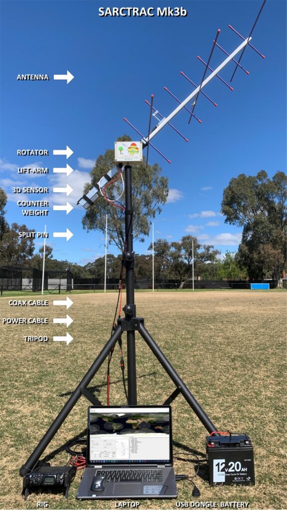
In January we posted about the AntRunner, which is a $325 (incl. shipping) satellite antenna rotator shipped from China. Recently we've come across another low cost satellite rotator from Australia called the "SARCTRAC Mk3b" which was developed as part of a school amateur radio educational program. This rotator fully assembled comes in at AU$400 + AU$50 worldwide shipping (US$290 + US$40 = US$330), making it's price comparable with the AntRunner. SARCTRAC can be purchased from the sarcnet products page. Currently only the fully built unit is available, but in the future they plan to offer a cheaper kit option.
We're yet to test the SARCTRAC Mk3b, but based on an overall review of it's advertising, it appears that the SARCTRAC has some superior specifications and a superior design when compared to the AntRunner.
Unlike the AntRunner, SARCTRAC comes with all its components enclosed in a waterproof IP65 rated enclosure. Its design also makes use of a 3D position sensor with magnetometer, allowing the unit to know its orientation at all times, meaning that it should be able to automatically position itself from startup. The design also makes use of DC motors with a built in worm gear drive, so the the motors back driving is not possible.
The system is controlled via a built in Raspberry Pi 3B+ and can communicate with the controlling PC via WiFi. Raspberry Pi's have stable WiFi connections, so we shouldn't see the connection problems that we had with the ESP32 based AntRunner.
Just like the AntRunner, SARCTRAC is only a lightweight rotator with torque specs of 50kg.cm static and 25kg.cm dynamic. So it should be able to handle counterbalanced Yagi beams, and lightweight dish antennas.
The SARCTRAC Mk3b. An Australian designed and made light duty antenna rotator.
SARCTRAC Mk3 Satellite Antenna Rotator Controller and TRACker
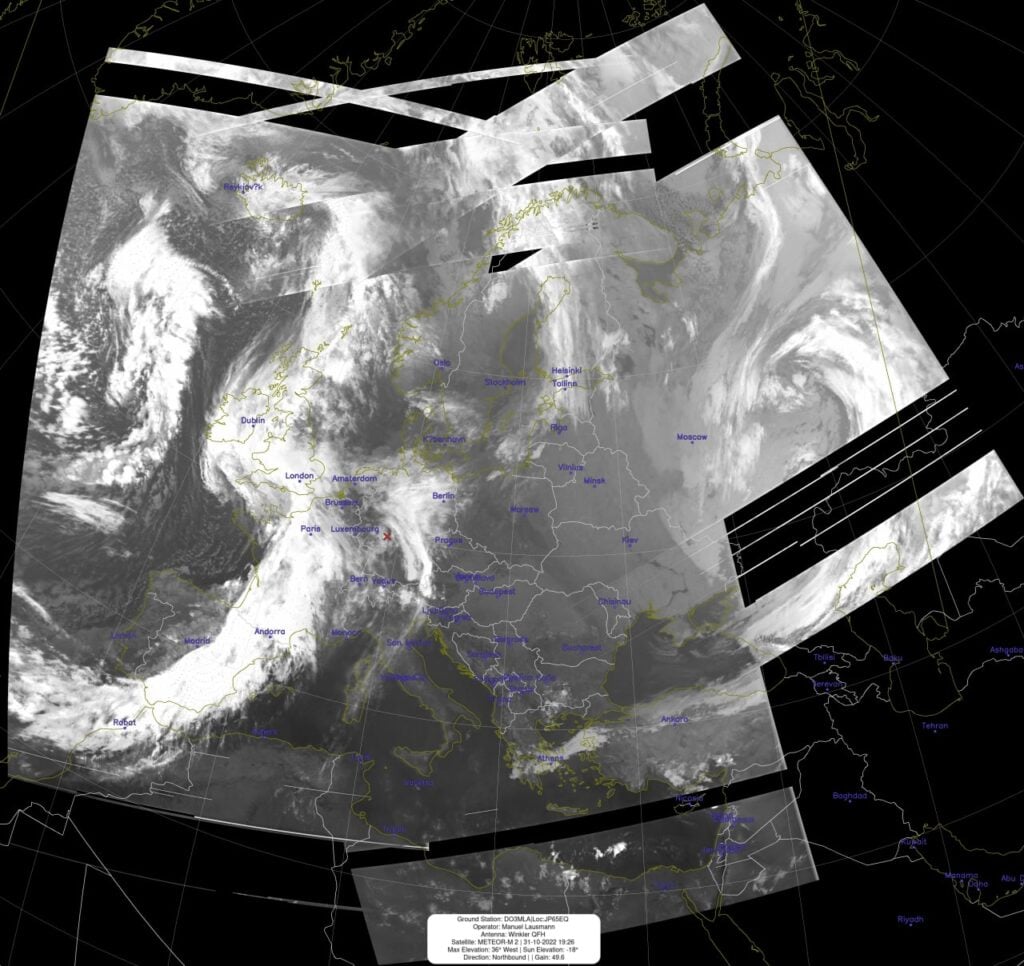
Meteor M2 is a Russian meteorological satellite whose LRPT transmissions at 137 MHz were relatively easily received by anyone with a simple satellite antenna and an RTL-SDR and computer. Meteor M2 was launched in July 2014, and it should not be confused with Meteor M2-1 which failed on launch in 2017 due to an upper stage deployment issue, or Meteor M2-2 which suffered a micrometeorite strike in 2019.
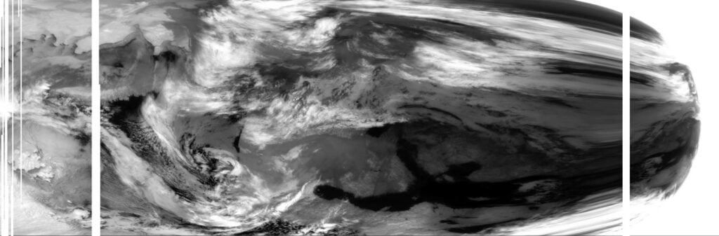
Unfortunately it appears that Meteor M2 has permanently failed on 24 December 2022. Problems with the Meteor M2 satellite losing orientation stability have occurred several times in the past, and have always been fixed within a few days after the event. There was initially hope that after the holidays when the engineers returned to work that the problem would be fixed. However @Serge, a Russian radio amateur who talks with Meteor engineers on Russian amateur radio forums has recently mentioned on Twitter that recovery seems unlikely.
As well as @Serge's twitter, Happysat keeps track of Meteor M2 satellites on his Meteor M2 status page so keep an eye there for any updates. At the moment all LRPT transmissions have been turned off.
In 2019 the Meteor M2-2 (the third M2 satellite) also failed in December due to a micrometeorite strike. Meteor M N2-2 was partially recovered, and while it can no longer transmit LRPT, it can still transmit HRPT in the L-band, when in sunlight.
The good news is that Meteor M2-3 is due to be launched in 2023, and this will hopefully bring back LRPT reception. Currently the only weather image satellites transmitting at 137 MHz are NOAA-15, NOAA-18 and NOAA-19. NOAA-15 still lives, but may be slowly failing. NOAA-18 and NOAA-19 are also aging satellites but show no signs of wear so far.
If you are interested in satellite reception and want to future proof your setup against more 137 MHz band satellite failures, we recommend looking in LRIT/HRIT or HRPT satellite reception which is a little more complex, but has become significantly easier to get started with in recent times.
Meteor M2 Failure: One of the last LRPT images received by Happysat before it was turned off.
Over on YouTube @dereksgc has been putting together a comprehensive video series on weather, amateur and other satellite reception. His series starts with receiving images from NOAA APT satellites, then Meteor M2, as then goes on to talk about low cost V-Dipole satellite antennas, how satellite dishes work, and recently how to use Ku-band LNBs with a satellite dish.
If you're getting started with RTL-SDR and satellite reception, this video series may be a good introduction for you.
Downloading images directly from weather satellites || Satellite reception pt.1
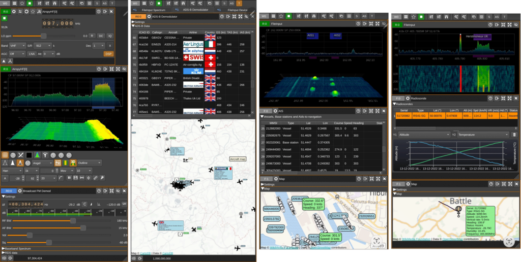
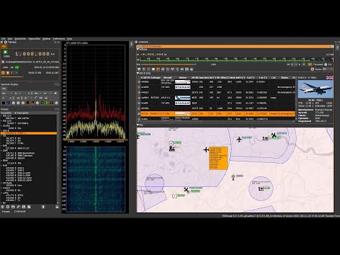
SDRangel is a free open source software defined radio program that is compatible with many SDRs, including RTL-SDRs. SDRAngel is set apart from other programs because of it's huge swath of built in demodulators and decoders.
Thank you to reader Jon for writing in and noting that SDRangel has recently been released for Android as a free Google Play download. This is an amazing development that could open up many doors into portable decoding setups as the Android version supports almost every decoder implemented on the desktop version. Jon writes:
It includes most of the functionality of the desktop version of SDRangel, including:
AM, FM, SSB, Broadcast FM and DAB, AIS, ADS-B, Digital Voice (DMR, dPMR, D-Star, FreeDV), Video (DVB-S, DVB-S2, NTSC, PAL), VOR, LoRa, M17, Packet (AX.25), Pager (POCSAG), Radiosonde (RS41), Time signal (MSF, DCF77, TDF and WWVB) modems.
RTL SDR, Airspy, Airspy HF, LimeSDR, HackRF and SDRplay support via USB OTG as well as networked SDRs
2D and 3D signal analysis in both time and frequency domain with statistical measurements of SNR, THD, THD+N, SINAD, SFDR and channel power
Satellite tracker, star tracker, maps and rotator controller
It should work on Android 6 and up. It’s a straight port of the desktop application, so although it will run on a phone, probably best used on a large tablet with a stylus or mouse.
Weather satellites that transmit HRPT give you high resolution uncompressed images of the earth. With an SDR, L-band feed, 60 cm or larger satellite dish and LNA+filter these images can be received by anyone. Derek OK9SGC has the definitive HRPT reception tutorial available here. However, as these are low earth orbit satellites, the user is required to find a way to track the satellite as it moves across the sky. With some skill and experience, hand tracking can work, but a motorized solution is really what is desired. Other applications such as ham satellite communications as well as radio astronomy projects may also benefit from motorized tracking .
Antenna rotators that rotate in azimuth and elevation can be used to track satellites moving across the sky. The problem is that antenna rotators are typically very expensive, or are a major task to DIY, involving circuit construction and 3D printing of parts.
Recently on Tindie we came across the "AntRunner" which is a relatively low cost portable antenna rotator from China coming in at US$325 with free shipping to most countries (VAT is added for the EU as $50 in shipping fees).
AntRunner is based on two geared stepper motors, a motor controller PCB and an open frame. AntRunners code is open source, as well as some partial hardware schematics.
It can be interfaced via a USB serial connection or through WiFi via it's onboard ESP32 chip, and it relies on the Hamlib 'rotctl' software library running on either the controlling PC, or another intermediary device like a Raspberry Pi. Once setup, software like Gpredict on the PC or Look4Sat on Android devices can be used to control the rotator.
The AntRunner: Low cost antenna rotator
AntRunner Tests
We ordered an AntRunner for testing with our own funds. Our setup involved a USB connection from the AntRunner to a Raspberry Pi, 12V plug pack and a 60cm dish. We installed hamlib on the Raspberry Pi, and used Gpredict (PC) and Look4Sat (Android) on networked devices to send the desired elevation and azimuth commands to hamlib on the Raspberry Pi for particular satellites.
(Note that if you are installing hamlib for the AntRunner, you should do so from source as the packages in Ubuntu 22.04 appear to be out of date. And the older version of hamlib installed via Ubuntu does not support the AntRunner).
Overall the AntRunner works as expected and was easily able to follow HRPT satellites across the sky. It was also great for easily pointing and switching between geostationary satellites like GOES and GK-2A. It easily held and moved a 60cm dish and feed which weighs about 3 kg. The specs of the AntRunner indicate 5 kg max load (although the GitHub specs note 10kg), so it should be able to hold larger diameter dishes as well.
However we did have an issue with the advertised WiFi connection which is an alternative to the USB serial connection. When connected to WiFi the connection would always drop after a single movement command was sent, and it would never reconnect unless rebooted twice. For this reason we abandoned WiFi and only used the USB serial connection, and communicated wirelessly via the Raspberry Pi. There is also a WiFi web interface available for testing movement commands and setting up the WiFi connection, but it is only in Chinese.
It's possible that RF noise from the motors was causing the WiFi disconnection, but on the frequencies that L-band satellites operate at, we did not notice any motor interference.
The AntRunner is advertised as a portable rotator, so that means it is not suitable for use in poor weather as it has no cover to protect the motor circuit board and motors themselves from rain. However, it is certainly small and light enough to be portable. You just need a portable 12V power supply as well.
Another issue is that when power is lost, the motors will spin freely, resulting in the antenna coming crashing down fast. So care must be taken when powering down with someone there to hold the antenna. The user is also required to physically hold the antenna level at 0 degrees elevation before powering up the AntRunner, so that it will reference 0 degrees elevation. Once powered the antenna holds in place.
There are also no limit switches on the device, so if an erroneous command is sent, it could send the motors into a position that could damage something.
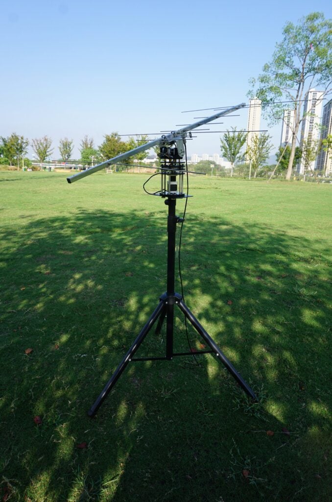
AntRunner (Image from Tindie) (NOTE: The tripod stand is not included)
Conclusion
Overall if you want something cheap and pretty much ready to use out of the box for tracking HRPT or other LEO satellites, the AntRunner is a good budget choice if you intend to only setup temporary stations. It is not suitable for permanent satellite receiver setups, at least not without some modifications.
A similar product is the SATRAN MK3 which was a 3D printed kit costing 175 Euros + shipping, but unfortunately this product appears to no longer be sold.
The ultimate in low cost rotators is probably the SatNOGS V3 rotator, but as mentioned this is a DIY project that requires a significant time commitment as it involves 3D printing multiple parts, sourcing components, building PCBs and constructing everything together. We have found one company offering a SatNOGs hardware kit, containing all of the parts required for US$445.
A commercial option might be the Yaesu G-5500DC which goes for US$759.95 on HRO, however you also need the GS-232 Rotator Computer Controller for computer control which is an additional US$589.95. Update: We've been informed that there are also cheaper third party computer controllers for Yaesu rotators, such as the CSN Technologies S.A.T Rotator Controller which sells for US$278.
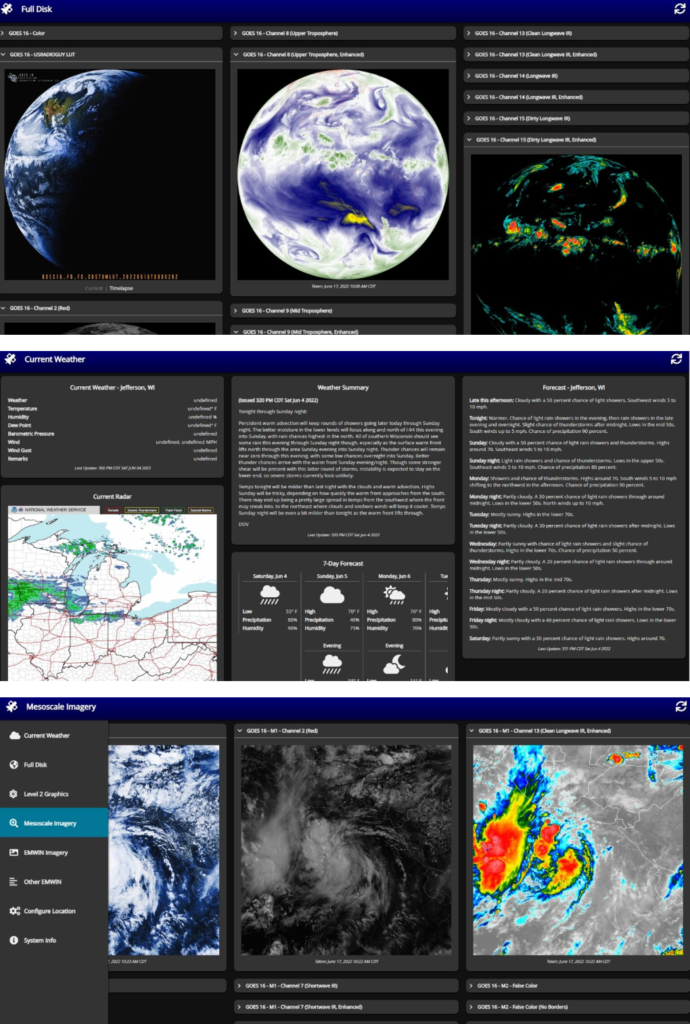
Thank you to Carl Reinemann (aka usradioguy) for submitting his article about Vitality GOES. Vitality GOES is an open source tool that displays the weather satellite images received by SatDump and/or goestools in a user friendly web interface that is accessible over a network connection.
SatDump and goestools are decoders that can be used to decode images from GOES and other satellites, when combined with a PC or single board computer, satellite antenna and RTL-SDR or similar SDR dongle. What they lack however is an easy way to display the received images, as the images are simply dumped to folders. If you're interested in getting started with GOES reception, we have a tutorial here.
Carl's article explains the purpose of Vitality GOES in detail and shows a few example screenshots. He notes how it can be used to display full disk images, composite together Meteor M2 images, present EMWIN data such as forecasts and warnings, and more.
Carl also notes that Vitality GOES was recently updated to V1.2 with the main update being added support for SatDump. SatDump can decode dozens of different weather satellites, not only GOES, so this opens up a wide range of possibilities.
Vitality GOES - Feature Overview
Vitality GOES: Example screenshots from Carl Reinemann (usaradioguy)
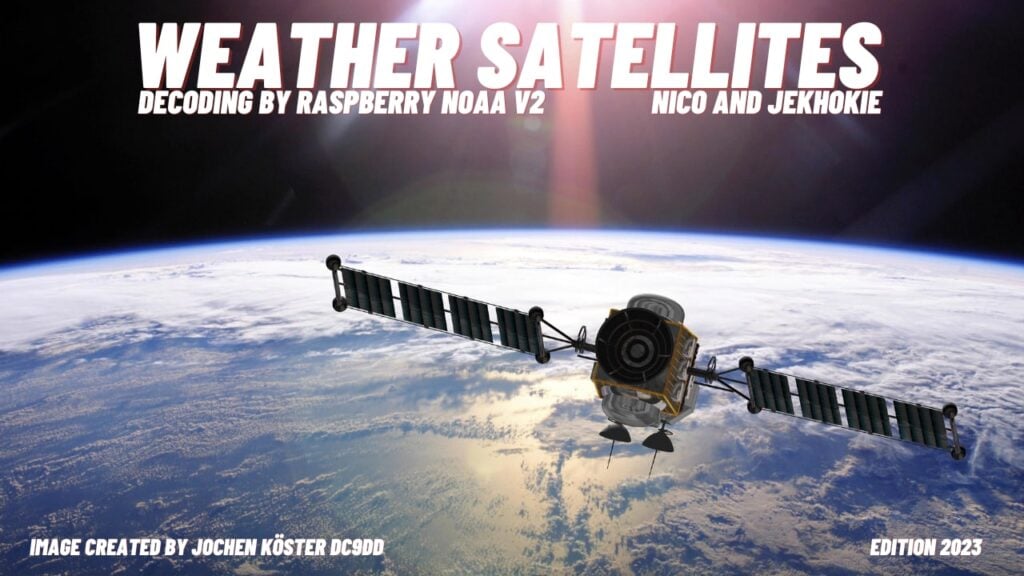
Thank you to Manuel Lausmann for submitting news about the release of the "Raspberry NOAA V2 Edition 2023" image for Raspberry Pi's. This image has been created by Jochen Köster (DC9DD), and contains a few enhancements over the previous image, mainly by including a program that allows users to create composite images of images from the Meteor weather satellites. Manuel writes:
This is based on the well-known Raspberry Noaa V2. In this image, however, the latest MeteorDemod has been added, which makes it possible to generate composite images, which was previously only possible under Windows with Meteorgis.
Furthermore, the image has an additional FTP uploader. The image was created by Jochen Köster DC9DD. It's available from today. This image is also part of my off-grid station in Northern Norway.
In his post Carl discusses in detail the technical aspects of the AVHRR Scan Motor failure, shows plots of the AVHRR motor current increasing, provides multiple examples of corrupt images being recently received and notes the history of previous failures which were eventually resolved.
He also notes that even with the AVHRR failure the other sensors on the satellite will remain functional, however a failure of this instrument would mean the end of the easy to receive APT images at 137 MHz from NOAA-15. We note that there is still the opportunity to receive NOAA-18 and NOAA-19 which are the remaining operational satellites that transmit APT at 137 MHz.
NOAA have now also released an official notice about the failure which reads:
Product Outage/Anomaly: NOAA-15 AVHRR degraded image data issued by NESDIS NSOF Date/Time Issued: Oct 22, 2022 1947Z
The NOAA-15 AVHRR Scan Motor current began showing signs of instability on Oct 18 at approximately 1800Z, when the current began to gradually rise from about 205 mA to about 250 mA, where it remained until Oct 24. At about 0000Z on Oct 24, the current began rising again throughout the day, peaking at about 302mA on Oct 25. Scan motor temperature began rising about the same time and is currently steady at ~29°C. The instrument is still producing data, but it is highly degraded. This behavior may be a sign of an impending scan motor stall but requires further investigation. Options for recovery are limited.