Tagged: satellite

SMOG-1 PocketQube Satellite Successfully Launched and in Orbit

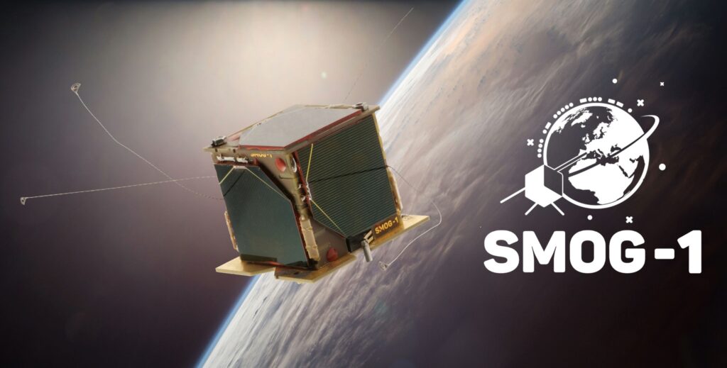
Thank you to Zoltan Doczi (HA7DCD) for submitting news about the successful launch and first reception of the SMOG-1 PocketQube Satellite (which is only 5x5x5cm in size). The pre-launch press release by Tech University of Budapest is available here, and the SMOG-1 Facebook page provided additional updates.

Back in April 2020 we first heard about the launch of SMOG-P which was the first functioning 1-PocketQube satellite, and was designed to measure electromagnetic pollution (electrosmog) from space. SMOG-1 is the successor to SMOG-P and it carries a similar mission to measure electromagnetic pollution generated by human activity in space around the Earth. Interestingly it also carries a magnetically lossy material under it's solar panels which is to act as a brake, reducing the 18-25 Orbital lifespan, thus reducing space trash after the primary mission is complete.

According to the receive and decoding instructions provided by Levente Dudas, SMOG-1 can be received with a simple satellite antennas, such as a handheld Yagi, Turnstile, Dipole or quadrifilar-helix antenna. The telemetry frequency is 437.345 MHz with callsign HA5BME. For the radio an RTL-SDR connected to a Raspberry Pi can be used, and the telemetry decoding software can be found on GitLab

SMOG-1 can be tracked here, although Zoltan mentions that the TLEs may not yet be accurate for several more days or weeks, as was seen with the launch of SMOG-P as well. The reason is that it is difficult for the NORAD radars to see these tiny PockQube satellites which is required for TLE generation.
Preorder Sale: Active L-Band 1525-1660 Inmarsat and Iridium Patch Back In Stock for $44.95

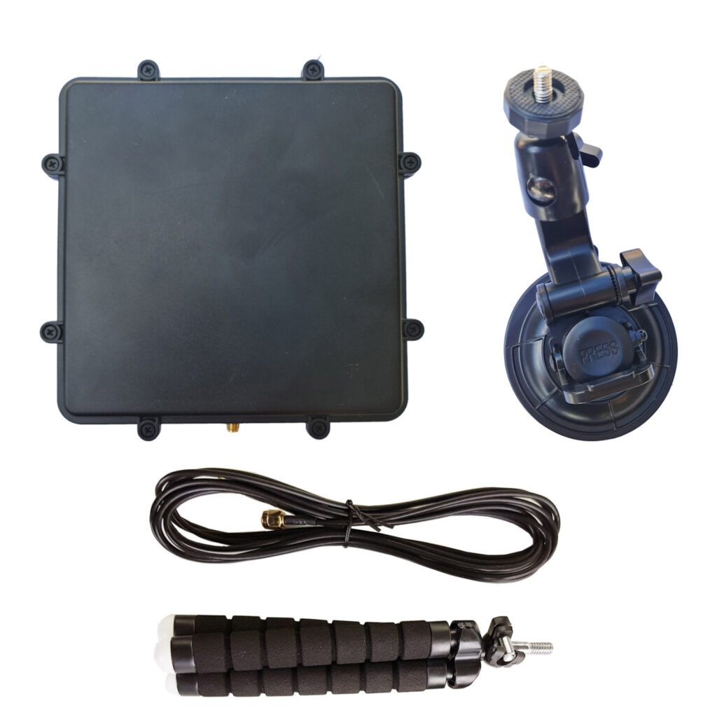
We have just received stock of our new L-band active patch antenna design. The antenna is designed for receiving RHCP L-band satellites such as Inmarsat, Iridium, GPS and other satellites that transmit between 1525 - 1660 MHz (please note that you cannot use it for weak signals that require a dish like HRPT or GOES). The antenna comes as a set with a large suction cup, 3M RG174 extension cable and bendable tripod to help with mounting. Preorder pricing is US$44.95 including free worldwide shipping to most countries shipped from our warehouse in Shanghai. At the end of this week (extended for one more week!) pricing will rise to the standard cost of US$49.95. Amazon stock will require time, and won't be in for at least 6+ weeks.

Please see our store to order the unit

Like our previous patch design, this is an actively amplified antenna as it contains a built in low noise amplifier which takes power from a 3.3 - 5V bias tee. This power is available from from our RTL-SDR Blog V3 dongles, and other SDRs like the Airspy, HackRF and SDRplay. It also has a built in SAW filter after the LNA to help reduce terrestrial interference.

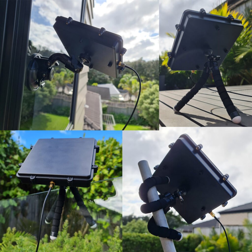
Compared to the previous design the new patch is larger (175 x 175 mm) with higher gain and wider radiation pattern. This allows for much easier pointing of the antenna and for much stronger signals. The upper frequency range has also been extended to 1660 MHz from 1625 MHz. The included suction cup is also much larger allowing for the patch to point at more angles without being restricted by the window. The patch is enclosed within a new weatherproof plastic enclosure. 

L-Band Patch with Accessories
L-Band Patch Mounting Examples

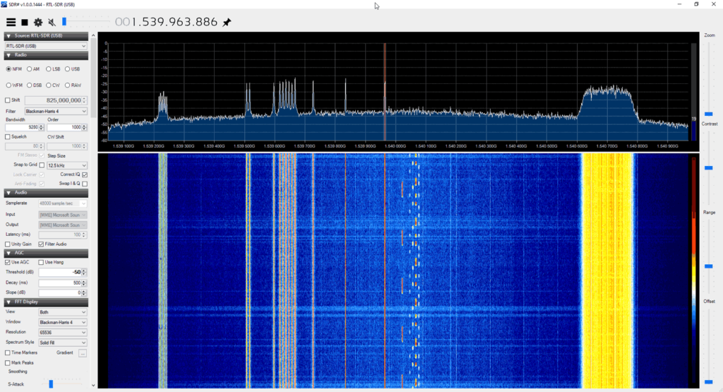
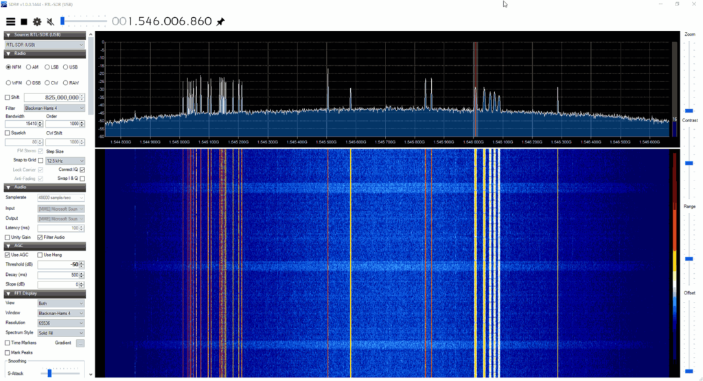
The screenshots below show the patch receiving various signals like AERO, STD-C and Iridium

Inmarsat Reception
Inmarsat Reception
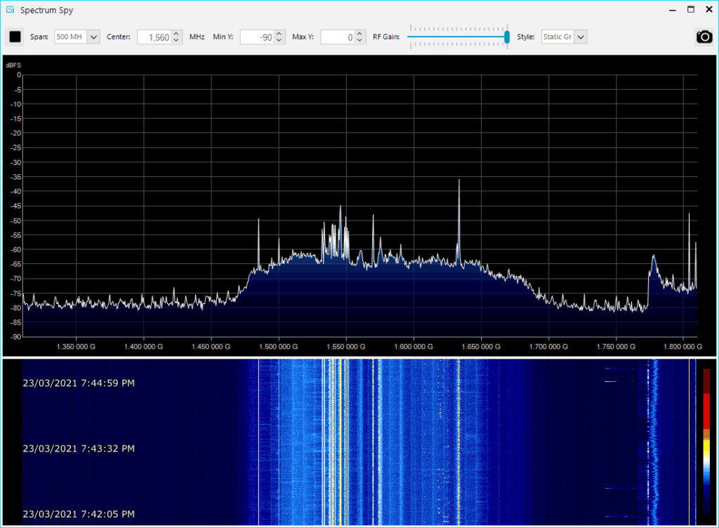
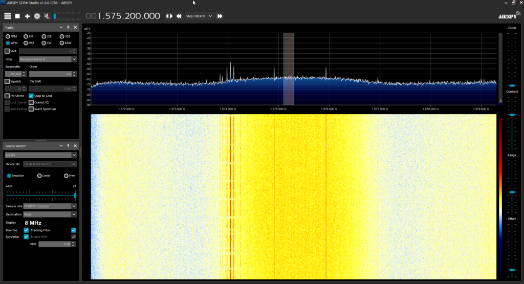
Airspy Showing Patch Bandwidth
GPS "hump" visible

Usage Tips

  • The antenna should be used with one meter or more of coax cable. It may perform poorly if the RTL-SDR is placed right at the antenna due to interference. If you want to run very long cable, then low loss coax should be used. 
  • The patch can be used flat, or angled towards the satellite. Angling it towards the satellite will yield significantly higher gain.
  • If you have very strong cell phone interference in your area, try using the patch a bit lower to the ground, and use buildings to block the interfering signal.
  • If you want to mount this on a car roof, you can use a standard mag-mount camera adapter.
  • When using the suction cup, ensure you wipe down the cup and the window surface before sticking it on. Have a backup plan in case the suction fails.

What can you do with this antenna?

Using 50 Lines of Python Code to Decode NOAA APT Weather Satellite Images

There are already many image decoders for the NOAA APT weather satellites available, with the most common and feature rich program being the abandoned freeware "WXtoIMG".

However many people may not know how simple the APT digital signal processing code is. Over on his blog post Dmitrii Eliuseev explains how only 50 lines of Python code are required to decode an image from received APT audio. Dmitrii's post shows how a Hilbert transform is used on the APT audio which is essentially the entire decoding step. This is then followed by a for loop that calculates the pixel luminosity from the decoded data, and plots it onto an image file. 

Of course the image is only grayscale (or in Dmitrii's case he decided to use greenscale), but adding false color and various other image enhancements found in advanced software like WXtoIMG are just standard image processing techniques.

Dmitrii concludes with the following:

Interesting to mention, that there are not so many operational radio communication systems in the world, the signal of which can be decoded using 20 lines of code. The NOAA satellites are about 20 years old, and when they finally will retire, the new ones will most likely be digital and format will be much more complex (the new Russian Meteor-M2 satellite is already transmitting digital data at 137 MHz). So those who want to try something simple to decode can be advised to hurry up.

[Also mentioned on Hackaday]

Simple decoding of NOAA APT satellites in Python

FengYun-2G Confirmed to be Receivable with a WiFi Grid Dish

Back in November 2020 we posted about the release of a decoder for the FengYun line of geostationary weather satellites which provide full disk images of the Earth and are positioned to cover parts of Europe, Africa, the Middle East, Asia, Russia, and Australia. Back then only a few people had attempted decoding this, and it was believed that a 120cm satellite dish or larger would be required.

However, today on Reddit user u/Harrison_Clark55 has shown that it is possible to receive FengYun-2G with a typical 90-100cm WiFi grid dish. These WiFi grid dish's have proven to work well for other geostationary weather satellites such as GOES and GK-2A.

We do note that u/Harrison_Clark55's image appears to be missing a few lines of data, and they are based in Australia where the elevation of FY-2G could be quite high depending on what side of the continent they are on. So it's possible that receivers in lower elevations may still require a larger dish size to work.

Full Disk FY-2G image received by u/Harrison_Clark55 (see the Reddit post for full resolution image)

SATRAN: An Affordable Motorized Satellite Antenna Rotator

Recently we came across the SATRAN project by Daniel Nikolajsen, which is an attempt to design, build and sell low cost kits of an automatic motorized satellite antenna rotator for less than US$200. A motorized satellite antenna rotator is useful for pointing high gain directional antennas such as a Yagi or satellite dish at low earth orbit satellites which can move across the sky quickly. This is also an idea used by the well known SATNOGS project which also provides a design for a 3D printed antenna rotator, and runs servers that archive received satellite data.

Compared to the SATNOGS design, the SATRAN design appears to be much simpler and easier to build. Although being a smaller unit it's only design to handle small compact antennas such as a 70cm Yagi. SATRAN is also controllable via a web interface and there is an Android App. The design is capable of rotating 360 degrees, and 110 degrees from zenith, which allows a user to cover the entire sky.

Daniel notes that SATRAN kits should be available for sale from Feburary/March 2021. He also notes that it is possible to 3D print most of the parts and to just purchase the electronics for a lower price.

More technical information about the project is available on it's Hackaday.io blog.

SATRAN 3D render and actual prototype

Using SDR to Investigate Telemetry Still Broadcasting from 1960’s Satellite Transit-5B5

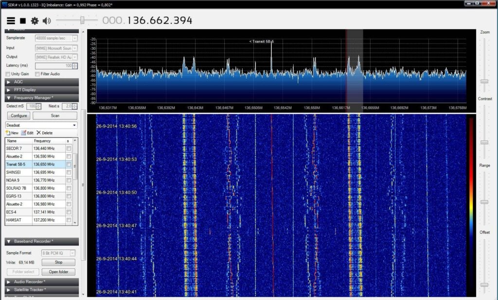
Thank you to Derek @ok9sgc for pointing us to some work Reddit user u/Xerbot has been doing on receiving telemetry coming down from a "dead" 1960's satellite called Transit-5B5. The fleet of Transit satellites was used for military navigation with the first launch in 1959 and the last in 1988. All in the fleet have since died apart from Transit-5B5 which continues to transmit telemetry at 137 MHz when receiving power from in the sun. Derek writes:

Turns out that the TRANSIT 5B-5 satellite's telemetry still has signs of some of the satellite's systems operating (albeit with a questionable reliability). The satellite represents an amazing legacy for all the people that worked on it in the 1950s and 60s, but due to its age it is also very difficult to find technical documentation about the telemetry (or I should rather say impossible), so to make sense of the data that's being broadcast by the satellite would require many people receiving, decoding, and comparing their results, mainly to identify any patterns in the satellite's behavior and the resulting demodulated data.

Derek and u/Xerbot are asking the SDR community to help collect more sample data, which might help in finding a way to decode some of the telemetry. If you have data to contribute, you can contact @ok9sgc on Twitter, and u/Xerbot on Reddit.

This reminds us of an old post from reader happysat where he demonstrated with an RTL-SDR that many "dead" satellites are actually still transmitting telemetry. Due to suspected chemical breakdown of the onboard batteries, the satellites tend to turn themselves on again when the solar panels receive sunlight.

The Transit-5B5 Satellite Telemetry Signal at 137 MHz

Tech Minds: Decoding Orbcomm Satellites with a Software Defined Radio

Over on his YouTube channel TechMinds has uploaded a new video showing how to decode signals from Orbcomm satellites. Orbcomm run a global network of low earth orbit satellites that perform services such as Internet of Things (IoT), Machine 2 Machine (M2M) communications, asset tracking, utilities telemetry, government communications and much more. The signals can be received at around 137 MHz.

In the video he explains how the private client data is encrypted, however it is possible to at least see the encrypted data coming down, and decode some of the data management information such as the transmitted uplink frequencies using a program called Orbcomm Plotter. Ultimately, the data available is quite boring to monitor, however decoding these satellites is still an interesting exercise.

Decoding Orbcomm Satellite Transmissions Using Software Defined Radio

FengYun-2H/G Geostationary Weather Satellite Now Decodable with 120cm Dish (Europe to Australia Coverage)

Hot on the heels of the GOES-13 weather satellite decoder that we posted about a few days ago, @aang254 has just released a new RTL-SDR compatible decoder for the FengYun-2H, 2G and possibly 2E geostationary weather satellites.

The FengYun-2 line of weather satellites are the Chinese equivalents to GOES, and they are positioned to cover parts of Europe, Africa, the Middle East, Asia, Russia, and Australia. So this is another geostationary weather satellite now available to Europeans which broadcasts in the L-Band at 1687.5 MHz. And unlike the weaker GOES-13 L-Band downlink, the FengYun-2 downlink is much stronger which means that reception with a 120cm satellite dish should be possible. We note that it has not yet been confirmed if the typical 90-100 cm WiFi dishes used with GOES-16 and 17 will be big enough to work. @aang254 writes:

Yesterday I successfully decoded the S-VISSR downlink from FengYun-2H thanks to a recording by @MartanBlaho. It is stronger than PDR on EWS-G1 (see Zbychu's signal twitter.com/ZSztanga/statu) meaning it should (untested) be doable with a 120cm (or smaller but no confirmation again) dish instead of 180cm.

It covers parts of Europe, Russia and down to Australia. FY-2G and FY-2E (no confirmation for this one yet) are also decodable in the same way. I released an early decoder, that currently is not suitable for automated setups but allows getting images already. A later version (that should come soon-ish) will allow live decoding / autonomous setups in a similar fashion to other satellites.

Also, the res is 2km/px on VIS and 8km/px on IR, so half that of GOES-13 with similar-ish coverage (Europe is less visible though).

(also forgot to say but the bandwidth is under 2Mhz, allowing a rtlsdr to be used)

https://github.com/altillimity/S-VISSR-Ingestor

FengYun 2H (Left) / 2G (Right) Coverage
FengYun-2H Image Courtesy of @ZSztanga and inverted by @petermeteor